
The vellum chart covers the North Atlantic and adjacent coastlines from the St Lawrence River to the mouth of the River Amazon and from Scotland to the west coast of North Africa. It was drawn by Nicholas Comberford of Stepney, originally from Kilkenny but apprenticed to a mapmaker at the London Drapers Company. He signed maps from 1626-1670, of which almost 30 survive.
http://comerfordfamily.blogspot.com/2007/12/comerford-profiles-6-nicholas.html
To the naked eye only tantalizing glimpses are revealed of some of the text and coastlines. The chart is badly water damaged, which would be hardly surprising if it had been at sea during its youth, although we cannot be certain this was the case. When it was conserved and removed from its original oak boards in 1983 cleaning was not possible, due to dirt having penetrated the fibres.
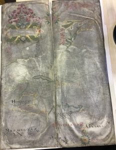
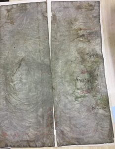
It is known to have been at the Cathedral in 1967 and following its re-discovery in the Medieval Library in 1982 it travelled to the British Library Maps Division for assessment. Subsequently it was passed to the National Maritime Museum in 1983, where it stayed until 2007, when it was returned to the Cathedral. The Cathedral Librarian, Julie Taylor, was contacted recently regarding its whereabouts and an entry will be added to the new Cathedral Catalogue when it is fully operational.
Permission was requested to use the University’s Crime Lite Imager (CLI), which was purchased as a result of the AHRC-funded forensic and historical investigation of fingerprints on medieval seals Imprint Project 2016-2018.
It was hoped that some of the text would become more legible using this equipment.
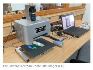
On the 1st May 2019 the chart was taken to the University and Dr Hollie Morgan gave a demonstration to History and Conservation staff and students. The CLI used advanced imaging and multi-wavelength illumination to reveal the faint text and coastlines. It was a rare opportunity to get up close and personal to a piece of documentary history, which might not be expected to be found in a cathedral library collection.
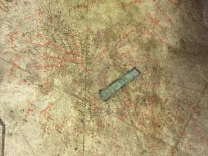 Normal photograph (actual size 1cm)
Red text is difficult to decipher but the CLI printout is always in black and white, which makes it far easier to read if you are familiar with 17th century handwriting!
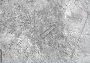 Crime Lite Imager (green wavelength, actual size 1cm)
The above image is one of many taken by Hollie courtesy of the CLI, green being the most effective wavelength for clarity. This useful collection of images could be used for future research into 17th century cartography.
See also
Tyacke, S. (2007) Chartmaking in England and its context, 1500-1660. In:
Woodward, D. (ed.) The history of cartography volume three (part two). Cartography in the European Renaissance. Chicago, USA: University of Chicago Press, 1722-1753.
For further information please contact carrand@lincoln.ac.uk
